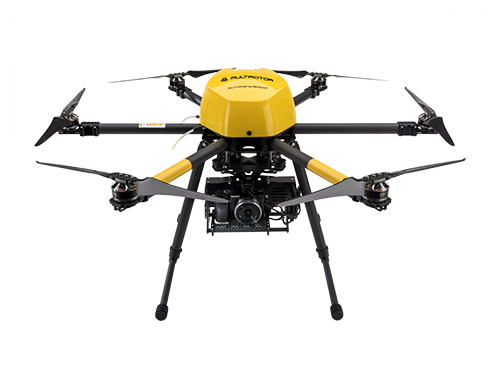
Unmanned Flight system for the creation of geotagged images, high-ground-resolution orthophotos, digital elevation models, point clouds, volume calculations and 3D models.
Set waypoints before or during the flight and depart autonomously
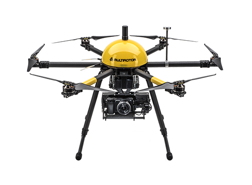
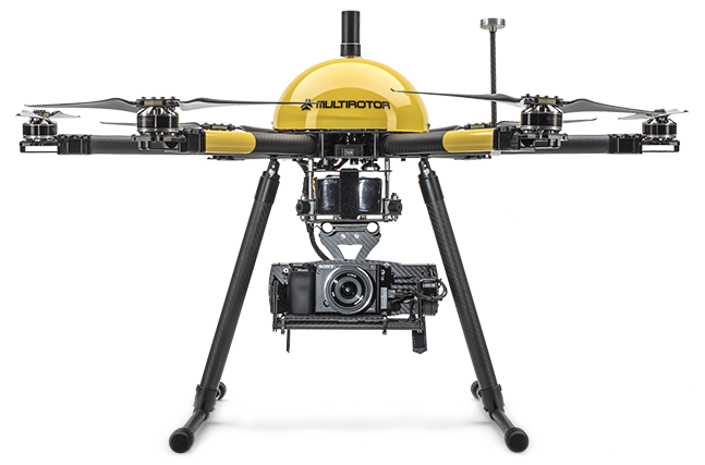
Complete including camera system and flight planning software
Wind-resistant for wind speeds up to 10 m / sec.
Ultra-compact, foldable carbon design
100% data security through stand-alone concept
Easy creation of 3D models and animations
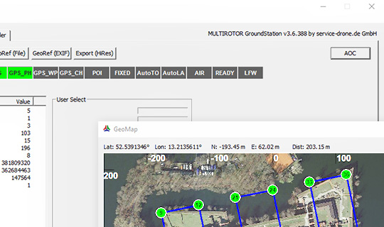
EasyReference
Surveying with an accuracy of up to 25mm without the need of ground control points
MULTIROTOR’s EasyReference High Density Flight Recorder and High-Precision Real-Time Kinematic Receiver (RTK) provide up to 25mm camera position calculation - without the need to use ground control points*. Just click on the Automatic Antenna Offset Correction (AOC) in the MULTIROTOR GroundStation software, and that’s it!
*) High-precision correction data is required, for example from SAPOS.
This technology is included exclusively in the XL EasyReference package.
- Shortened planning phase without control points
- Reduced use of personnel and equipment
- Trouble-free measurement during operation
- Faster image capture and post-processing
- Safe and high-precision surveying even in dangerous or inaccessible terrain
- Precise camera position data with one click
Product features and specifications
| Attitude control 512 times per second | Yes |
| Automatic treble control 24-bit barometric | Yes |
| Autonomous flight max. 500 waypoints | Yes |
| Autostart / autolanding assistant | Yes |
| Cantilever beam fold system | Yes |
| Camera suspension | Brushless Gimbal |
| Digital option port (for future applications) | Yes |
| Digital RC transmitter pilot | Jeti dc-16 |
| Dimensions | Ø 85 cm, H 49 cm |
| Drive redundancy | Yes |
| Emergency Landing | Yes |
| Flight Control MULTIROTOR G4 Dual 32 bit | Yes |
| Flight Control redundancy | Optional |
| Flight data log | 128 Hz |
| GPS flight assistant (position Hold, Coming Home) | Yes |
| L1 GPS | Yes |
| Display | 7" LCD HD Live View Diversity |
| Pack size | 88x45x22 cm |
| Servo connectors | 6 |
| Max. airspeed | 30 km/h |
| Max. Flight time (ideal) | 28 Min. |
| Max. Take-off weight (ideal) | 5000 g |
| Payload (incl. camera suspension and flight battery) | 2300 g |
| Wind stable till | 10 m/s |
| Integration of other camera systems | Optional |
| Special integration of the Sony Alpha 7RII Camera | Optional |
| System integration Tetracam ADC-Micro Multispectral Camera | Optional |
| Thermographic camera | Optional |
| Optional flight battery short circuit fuse | Optional |
| Agisoft PhotoScan Professional Edition - Stand-Alone licence | Optional |
| Hardcase MULTIROTOR Surveying-Robot G4 | Optional |
| LiPo-flight battery heating case | Optional |
| Upgrade & Maintenance Contract MULTIROTOR Surveying-Robot G4 | Optional |
| Inspection (12 months, 25 flight lines, 350 starts) | Optional |
| Device hull insurance Europe | Optional |
| 1-day individual practical training incl. flying experience certificate | Optional |
| 2-days practical training surveying incl. flying experience certificate | Optional |