100% Made by Multirotor
A high-performance system for effective Detect and Avoid (DAA) using drones Beyond visual line of sight (BVLOS)
Detection of ADS-B transponder and FLARM signals of manned aircraft
Automatic airspace analysis with warning of critical approaches
Fail-safe processing of airspace data on a high-performance redundant server
Stand alone system or full integration into the Multirotor Ground Control Station (GCS)
Optional RTK base station to provide correction data
High positioning accuracy and fully autonomous landing to within a few millimetres
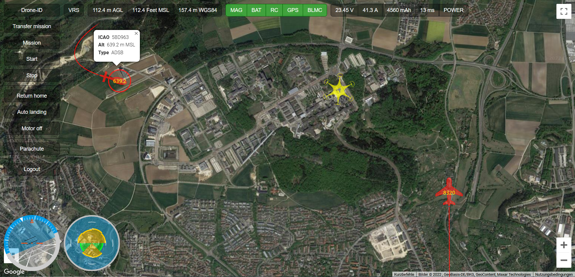
AirSenseAir situation display and UTM at new levels of performance
Collision avoidance in the airspace between manned and unmanned aviation is becoming increasingly important. For drones beyond the visual line of sight, we have therefore developed AirSense, a high-performance system for effective detect and avoid (DAA).
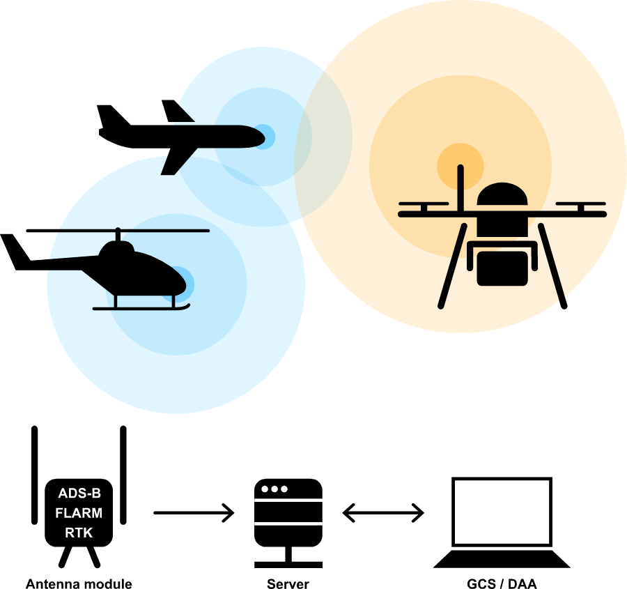
Its antenna module receives transponder signals and forwards them to the AirSense server via a mobile data connection. However, it can also be used as a base station to provide correction data. This enables the positional accuracy of the multirotor drone to within a few mm, which again opens up new possibilities, especially for fully autonomous landing.
AirSense can be booked stand alone as a DAA solution via direct access (laptop or smart device), but is also fully compatible with the Multirotor Ground Control Station (GCS).
Everything at a glance
Airspace monitoring with AirSense in the Ground Control Station
One screen, more overview
Customers operating a multirotor drone with the latest, triple-redundant flight control generation beyond visual line-of-sight (BVLOS) receive the current air situation image of the environment directly in the live image of the GCS. This eliminates the need to operate a separate DAA solution with an additional screen, as is currently necessary when integrating third-party products.
Fast data acquisition
Flight paths of individual aircraft are traced over the last known positions, as well as identifier, flight altitude and type of air traffic (helicopter, aircraft or drone) are displayed.